
Search Data.gov
Found 98 dataset(s) matching "hotspots".
-
This dataset provides monthly statistics for the Wi-Fi 2 Geaux Program for hotspots checked-out from all East Baton Rouge Parish Libraries. The stats are organized by branch, year and month. Also,...
-
This data set comprises maps of predicted long-term groundfish biodiversity hotspot probabilities off the Pacific Coast of Oregon. Predicted hotspot probabilities are given for four biodiversity...
-
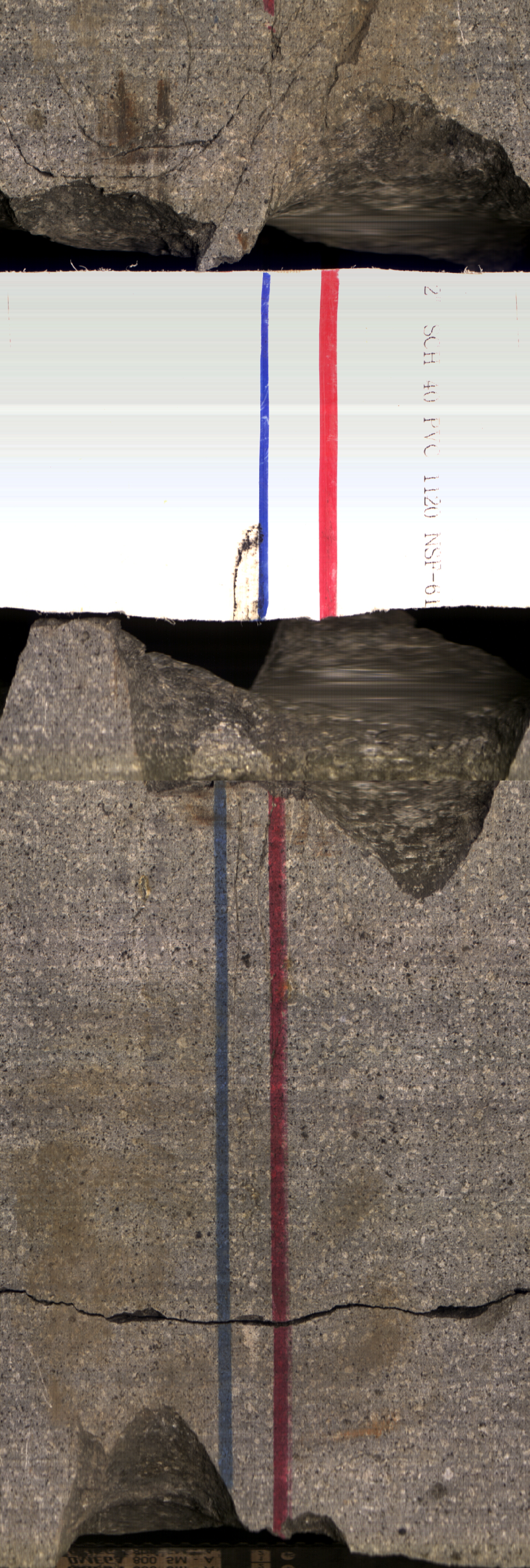
This submission contains links to two open source published papers on the Kimama core hole, Project Hotspot. "Volcanic stratigraphy and age model of the Kimama deep borehole (Project Hotspot)" -...
-
This dataset includes maps of the locations and number of methane ebullition hotspots in 15 frozen lakes in the southern portion of the Goldstream Valley and the surrounding landscape just north...
-
This is the dataset used for the U.S. lead exposure risk hotspot analysis in Zartarian et al., 2024, ES&T. The data dictionary files explain the contents of the 2 included zipped data folders. The...
-
A raster surface identifying hotspots of conservation priority based on 375 location records (89 unique geographic locations) of 28 species of Carnivora in Peninsular Malaysia. Hot spot analysis...
-
We modeled historical and future stream fish distributions using a suite of environmental covariates derived from high-resolution hydrologic and climatic modeling of the basin. We quantified...
-
We modeled historical and future stream fish distributions using a suite of environmental covariates derived from high-resolution hydrologic and climatic modeling of the basin. We quantified...
-
The Food Insecurity Hotspots Data Set consists of grids at 250 meter (~7.2 arc-seconds) resolution that identify the level of intensity and frequency of food insecurity over the 10 years between...
-
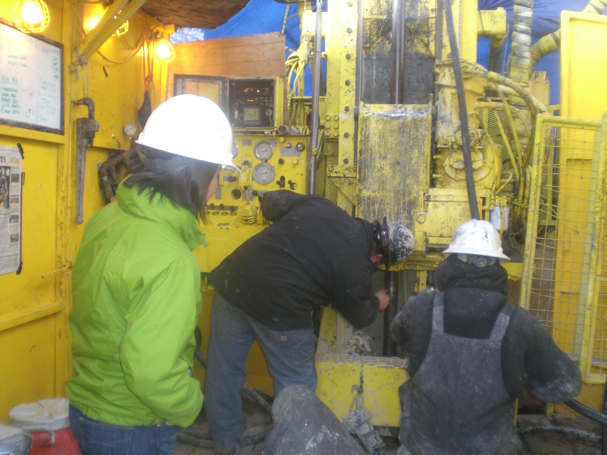
Project Hotspot drilled 3 slim hole exploratory wells in southern Idaho, each just under 2 km deep. These holes were designed to investigate thermal structure in three different settings within...
-
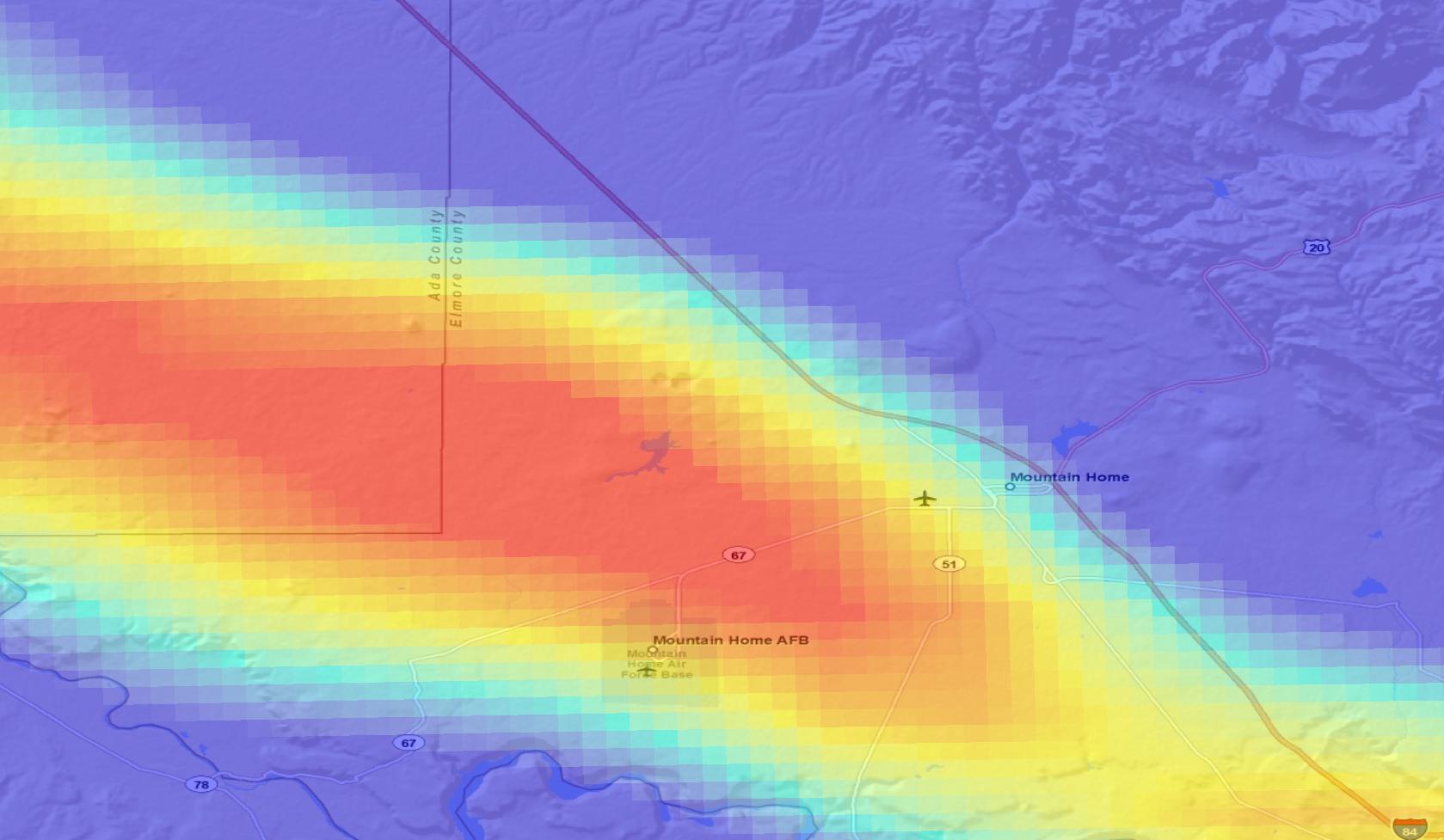
Surface Urban Heat Island (SUHI) hotspot data are defined as areas of statistically high land surface temperature (LST). A pixel is determined as statistically high if it exceeds one standard...
-
Surface Urban Heat Island (SUHI) hotspot data are defined as areas of statistically high land surface temperature (LST). A pixel is determined as statistically high if it exceeds one standard...
-
Project Hotspot applies innovative approaches to geothermal exploration in the Snake River Volcanic Province. This report summarizes results from our Phase 1 data compilation.
-
Surface Urban Heat Island (SUHI) hotspot data are defined as areas of statistically high land surface temperature (LST). A pixel is determined as statistically high if it exceeds one standard...
