
Search Data.gov
Found 1073 dataset(s) matching "amplitude".
-
Coal bursts (damaging seismic events in underground coal mines) pose a substantial threat to operations and mine workers. The underground coal mines in Colorado’s North Fork Valley (NFV) have...
-
CO2 is studied using dispersed synchrotron radiation in the 650 Å and 840 Å spectral region. The vibrationally resolved photoelectron spectra are analyzed to generate relative vibrational...
-
A refined earthquake mechanism catalog for southern Califiornia using the HASH method and locations derived from waveform cross-correlation. Each focal mechanism is obtained from grid searching...
-
Absorption of radio waves occurs when electrons responding to the wave fields collide with and transfer energy to the neutral particles. A study of ionospheric absorption yields information on...
-
GPM GROUND VALIDATION ENVIRONMENT CANADA (EC) PRECIPITATION OCCURRENCE SENSOR SYSTEM (POSS) GCPEX V1
The GPM Ground Validation Environment Canada (EC) Precipitation Occurrence Sensor System (POSS) GCPEx dataset is comprised of data gathered during the GPM Cold-season Precipitation Experiment...
-
**Overview** Monitor real-time profiles of virtual temperature (C), wind speed (ms-1), and direction (deg) few km above ground level. **Data Details** Raw files contain radial velocity (ms-1),...
-
Included are experimental data recorded from shear experiments that specifically explore the link between fluid-injection rate and seismic moment resulting from shear reactivation of laboratory...
-
Amplitude images (both vertical and depth slices) extracted from 3D seismic reflection survey over area of Walker Ranch area (adjacent to Raft River). Crossline spacing of 660 feet and inline of...
-
Coal bursts (damaging seismic events in underground coal mines) pose a substantial threat to operations and mine workers. The underground coal mines in Colorado’s North Fork Valley (NFV) have...
-
MSLSP V1 data was decommissioned on December 14, 2021. Users are encouraged to use the improved [MSLSP V1.1](https://doi.org/10.5067/Community/MuSLI/MSLSP30NA.011) data product.NASA’s Multi-Source...
-
Coal bursts (damaging seismic events in underground coal mines) pose a substantial threat to operations and mine workers. The underground coal mines in Colorado’s North Fork Valley (NFV) have...
-
This data set, part of the NASA Making Earth System Data Records for Use in Research Environments (MEaSUREs) program, provides a complete land ice and ocean classification mask for the Greenland...
-
This dataset consists of high resolution sea surface winds data produced from Synthetic Aperture Radar (SAR) on board Sentinel-1A and Sentinel-1B satellites. The basic archive file is a netCDF-4...
-
Coal bursts (damaging seismic events in underground coal mines) pose a substantial threat to operations and mine workers. The underground coal mines in Colorado’s North Fork Valley (NFV) have...
-
In September 2013, an experiment using Distributed Acoustic Sensing (DAS) was conducted at Garner Valley, a test site of the University of California Santa Barbara (Lancelle et al., 2014). This...
-
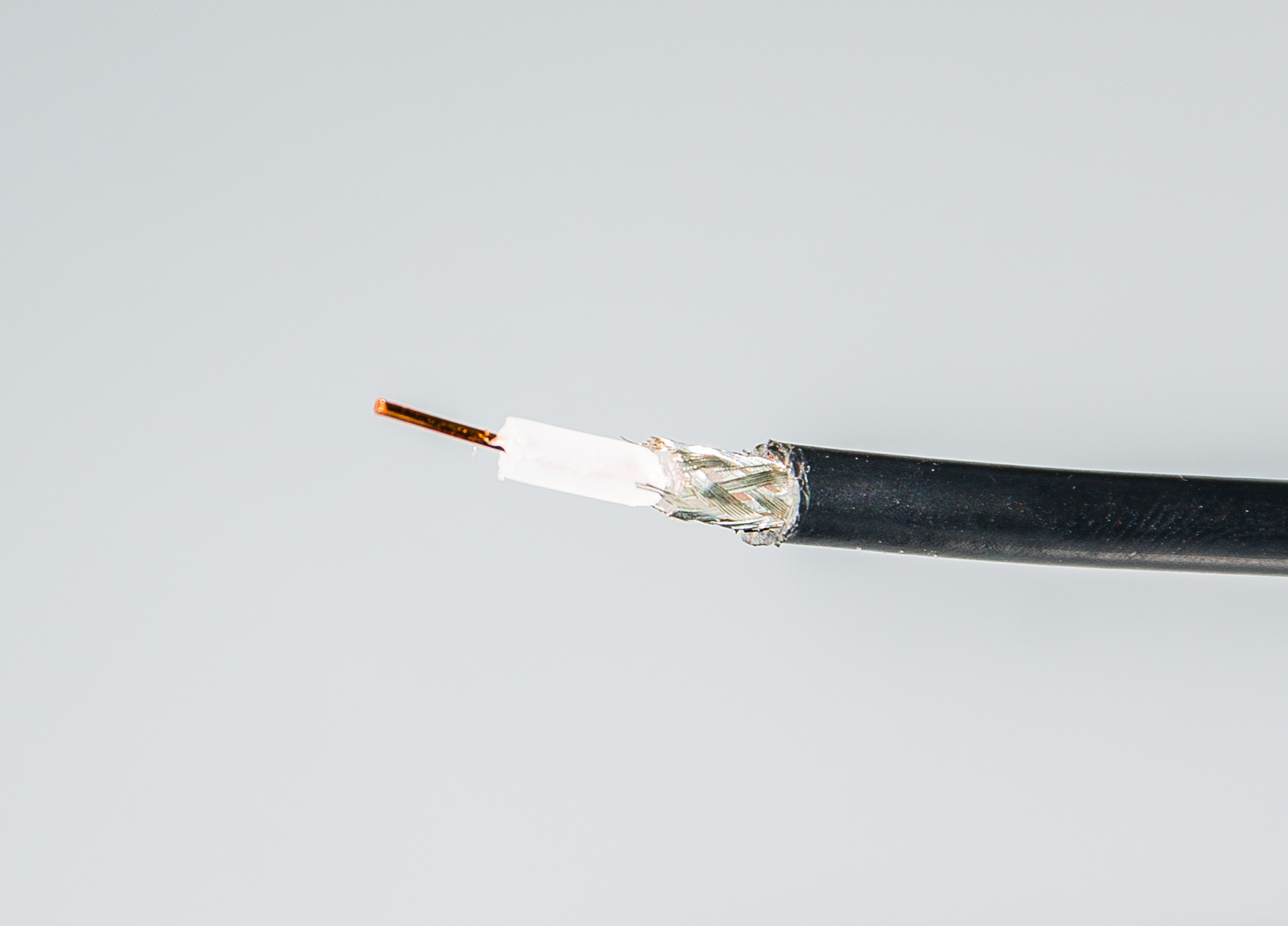
The coaxial-cable experiment conducted in the lab was with 80 m coaxial cable( RG-85). This experiment compares the TDR response between damaged and undamaged cable. For the damaged cable, the...
-
The late Taro Takahashi (LDEO/Columbia University) provided the first near-global monthly air-sea CO2 flux climatology in Takahashi et al. (1997), based on available surface water partial pressure...
