
Search Data.gov
Found 6629 dataset(s) matching "location map".
-
The maps in this data release show active landslide structures in three areas along the north flank of the Slumgullion landslide. After the entire active part of the landslide was mapped in 1992...
-
This Data Release provides tabular and geospatial data digitized by the U.S. Geological Survey (USGS) from a U.S. Bureau of Mines (USBoM) report titled Mineral Investigation of Sangre de Cristo...
-
The 1:100,000-scale geologic map of the South Boston 30' x 60' quadrangle, Virginia and North Carolina, provides geologic information for the Piedmont along the I-85 and U.S. Route 58 corridors...
-
This data package contains information and maps showing the geology and biology of select submerged lands (0 to 50 meters deep) around Navy Base Guam (NBG) and Haputo Ecological Reserve Area (ERA)...
-
Locate a permit by address or filter by Ward. Use your device current location to find a permit nearby. The application will zoom to the location on the map and relevant information about the...
-
<p style='margin-top:0px; margin-bottom:0px; box-sizing:border-box; padding:0px; color:rgb(5, 5, 5); font-family:"Avenir Next", "Helvetica Neue", sans-serif, "PingFang...
-
These data represent the locations of sediment sampling, the associated watershed boundaries for those sites, and the extents of sealed and unsealed parking lot pavement within 10 urban...
-
Gap Analysis Project (GAP) habitat maps are predictions of the spatial distribution of suitable environmental and land cover conditions within the United States for individual species. Mapped...
-
Location maps of monitoring sites and measured parameters in the NY State Ambient Air Monitoring Network
-
The Chattanooga Shale is relatively thin and generally continuous across the state, making it an important geologic horizon. In Tennessee, the Chattanooga Shale crops out along the escarpment...
-
Healthy Access Locator map can be used to view schools that have received a Healthier US Schools Challenge Award (HUSSC). To get started, click on Search Awards and enter your search criteria....
-
Critical minerals are essential for the energy transition; to meet sustainability goals, production of these resources must significantly increase within the coming decades. For example, demand...
-
The locations on this map provide COVID-19 testing for anyone who is experiencing COVID-19 symptoms or has been in close contact with someone who has COVID-19. Many of the locations are free and...
-
The map shows the locations where the public may find Voter Information Brochures for the 2016 Mobility Bond. Learn more about the proposed bond at www.AustinTexas.gov/2016Bond. For questions,...
-
Clickable map tool to locate and find information about United States Warehouse Act Licensed Warehouses
-
Two active landslides at and near the retreating front of Barry Glacier at the head of Barry Arm Fjord in southern Alaska could generate tsunamis if they failed rapidly and entered the water of...
-
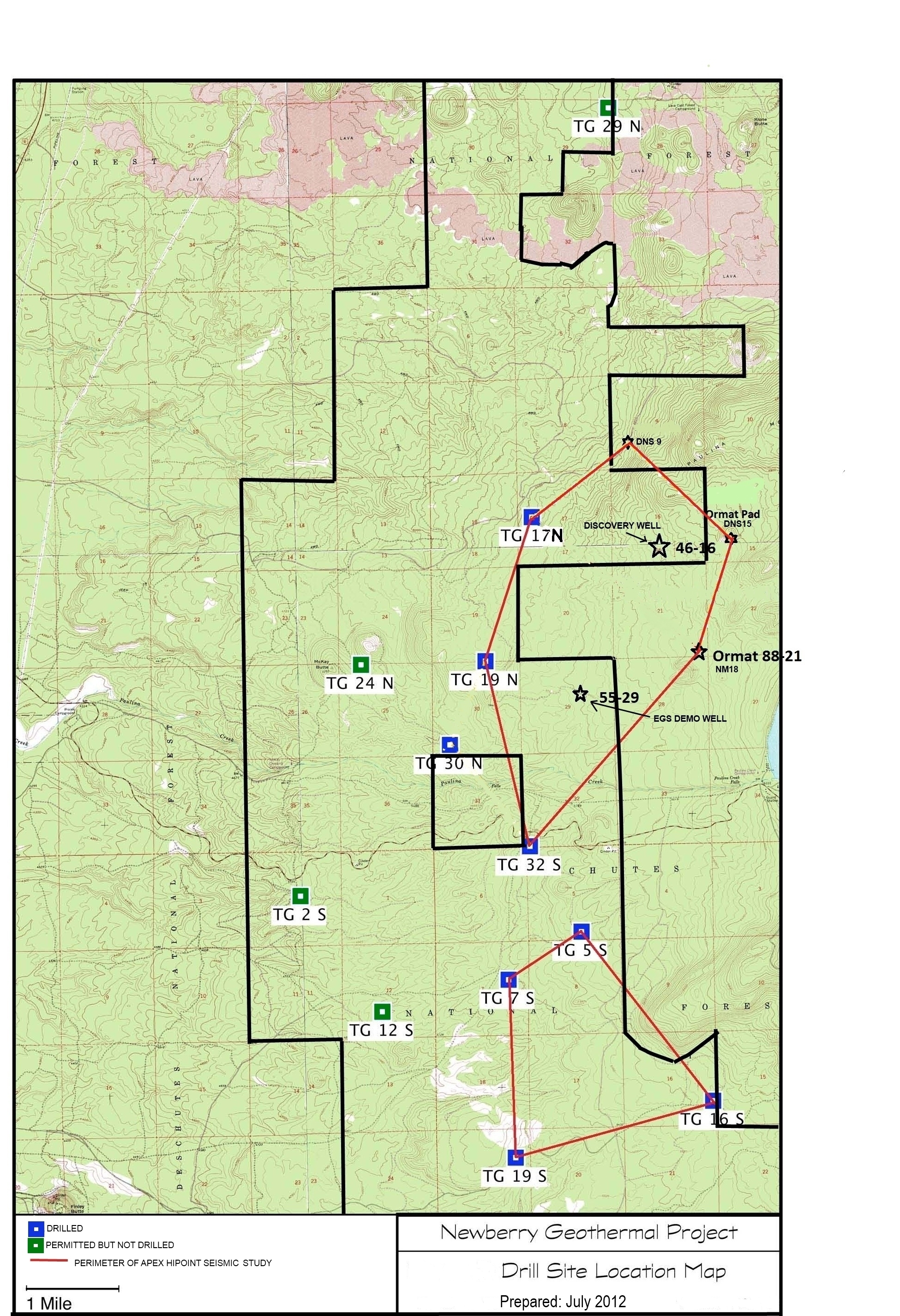
A map showing location of wells permitted, drilled and seismic test, as part of validation of innovative exploration technologies done for the Newberry Volcano project in 2012.
-
This dataset is the third installment of a yearly connectivity update for forested habitat within the Great Lakes Restoration Initiative's (GLRI) Terrestrial Habitats & Connectivity (TH&C)...
