
Search Data.gov
Found 142 dataset(s) matching "PFA".
-
This dataset extends the development of the Renewable Energy Potential (reV) model to include geothermal energy, with a specific focus on Hawaii. Provided here are the results of two scenarios...
-
This report details all of the work done in Phase 2 of a geothermal exploration project in Tularosa Basin, New Mexico. Data acquired as part of Phase 2 includes field geology (geological...
-
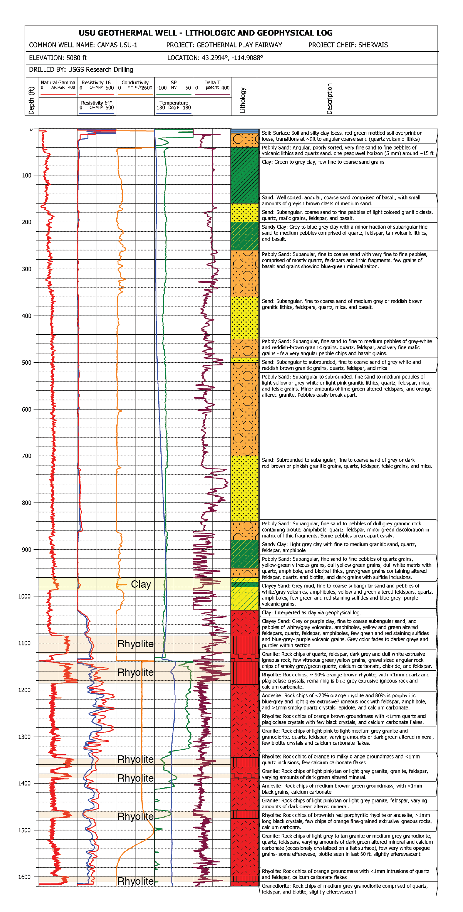
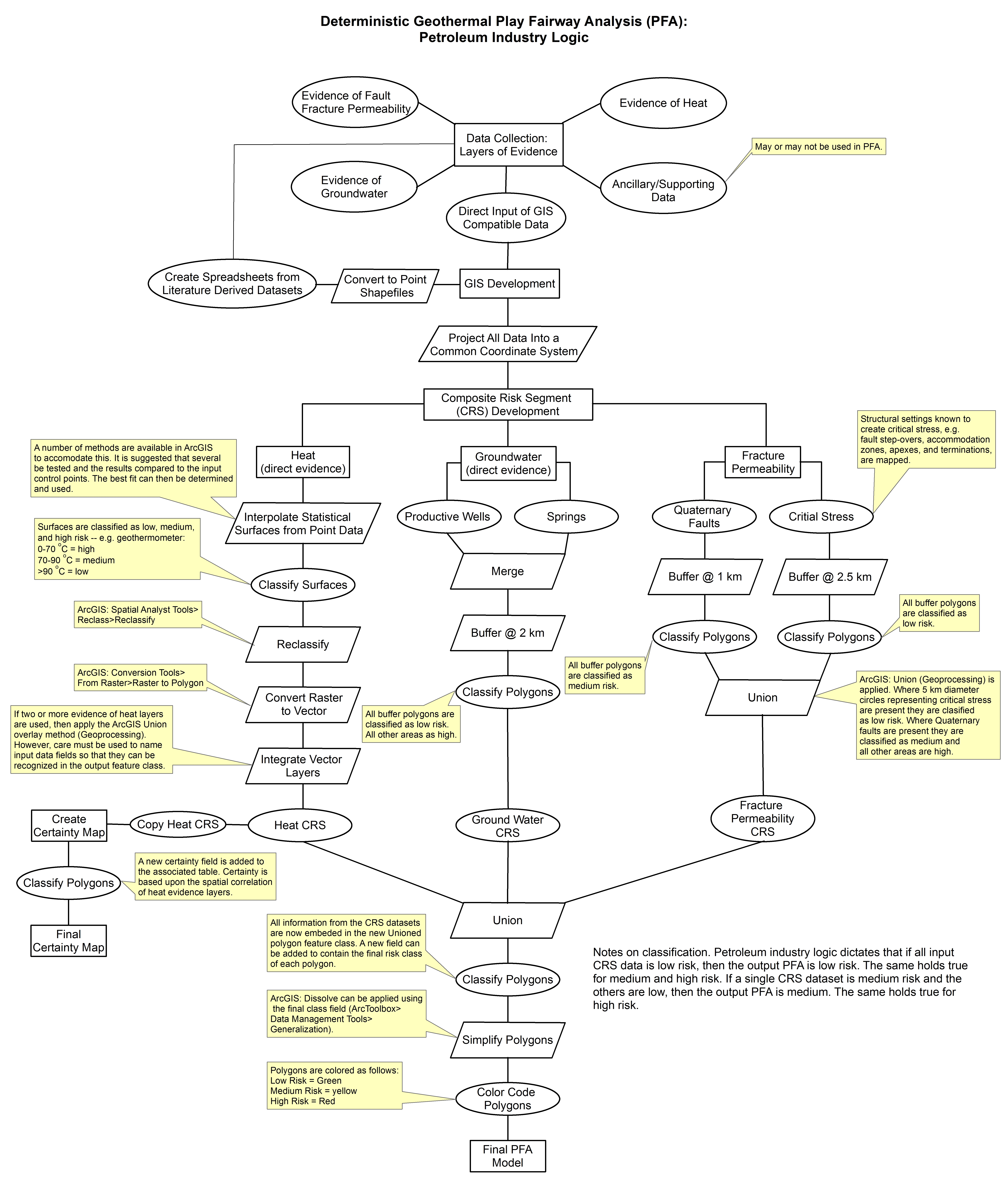
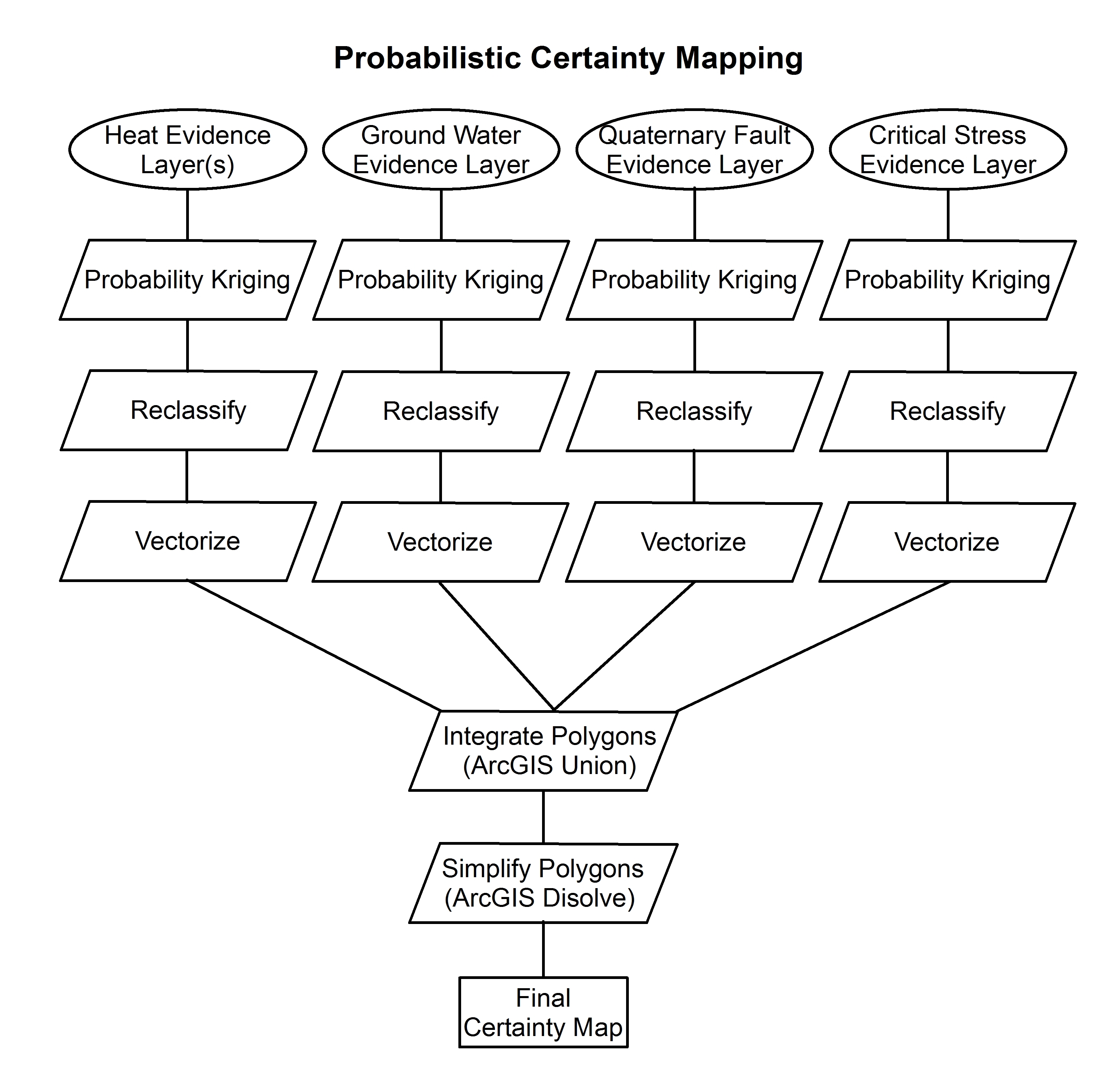
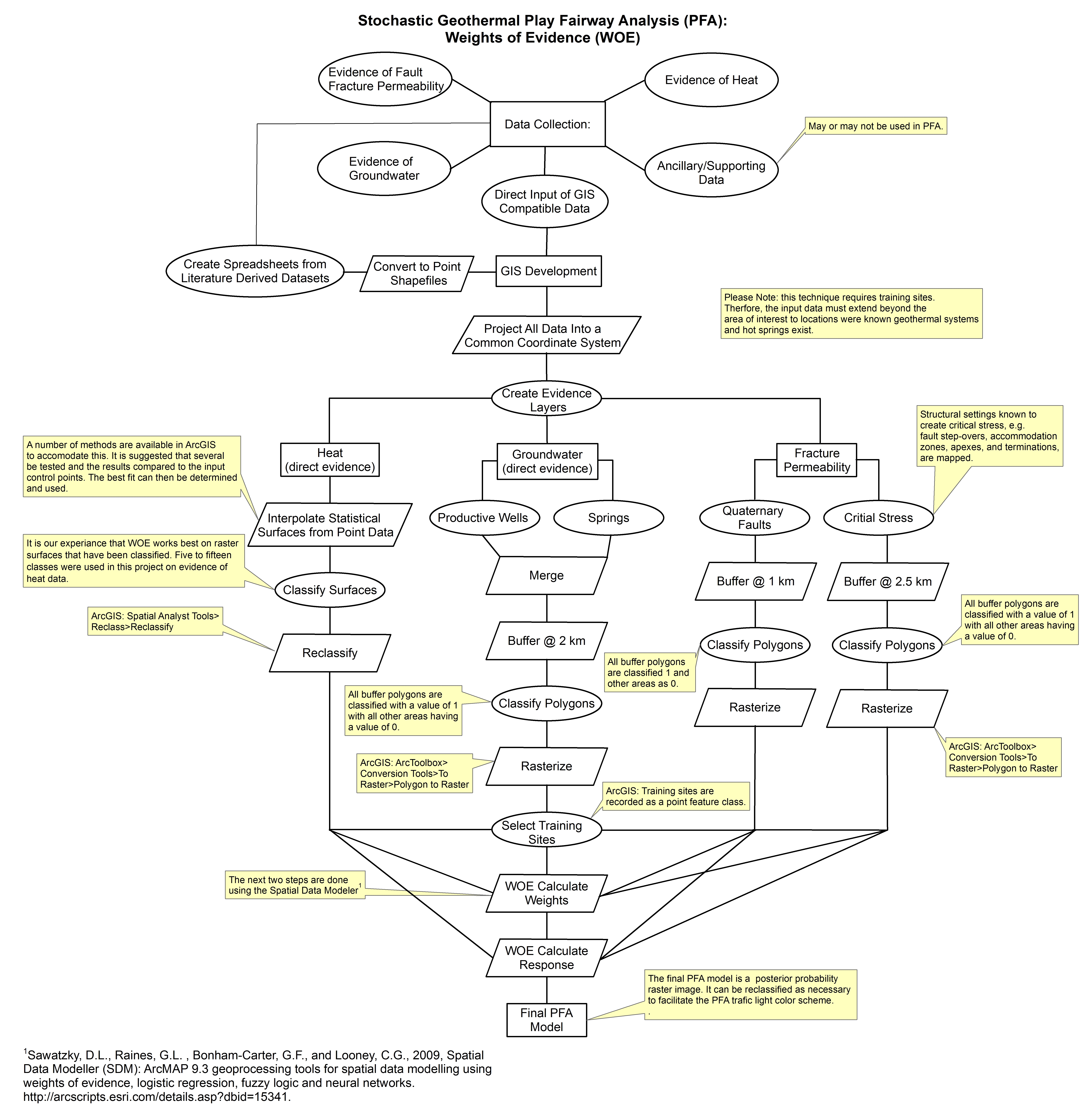
These images show the comprehensive methodology used for creation of a Play Fairway Analysis to explore the geothermal resource potential of the Tularosa Basin, New Mexico. The deterministic...
-
Maryland Total New Parcels for Residential Development - New Parcels for Residential Development from 2010 through and including 2023 based on the PFA boundaries and MdProperty View Edition year...
-
This data set reports monthly averages of atmospheric CO2 concentration from satellite and airborne observations between 2009 and 2013 and simulated present and future monthly concentrations and...
-
Custom MATLAB and custom GMT scripts for Hawaii Play Fairway Analysis modeling.
-
The files included in this submission contain all data pertinent to the methods and results of this task's output, which is a cohesive multi-state map of all known potential geothermal reservoirs...
-
This submission includes three files from two sources. One file is derived from USGS data and includes a series of manipulations to evaluate only shallow wells with high estimated geothermal...
-
Groundwater flow model for the island of Oahu. Data is from the following sources: Rotzoll, K., A.I. El-Kadi. 2007. Numerical Ground-Water Flow Simulation for Red Hill Fuel Storage Facilities,...
-
Compilation of boron, lithium, bromine, and silica data from wells and springs throughout New Mexico from a wide variety of sources. The chalcedony geothermometry calculation is included in this file.
-
Rock formation top picks from oil wells from southwestern New Mexico from scout cards and other sources. There are differing formation tops interpretations for some wells, so for those wells...
-
Groundwater flow model for Hawaii Island. Data is from the following sources: Whittier, R.B., K. Rotzoll, S. Dhal, A.I. El-Kadi, C. Ray, G. Chen, and D. Chang. 2004. Hawaii Source Water...
-
.csv file consisting of the water well temperature and water table elevation for wells in the State of Hawaii. Data source, Hawaii Commission of Water Resources Management.
-
This is an updated and simplified version of the New Mexico heat flow data already on the NGDS that was used for Play Fairway analysis.
-
This file contains a compilation of BHT data from oil wells in southwestern New Mexico. Surface temperature is calculated using the collar elevation. An estimate of geothermal gradient is...
