
Search Data.gov
Found 39046 dataset(s) matching "geologic".
-
This is a compilation of logs and data from Well 82-33 in the Roosevelt Hot Springs area in Utah. This well is also in the Utah FORGE study area. The file is in a compressed .zip format and there...
-
This is a link to the Automated Geographic Reference Center (AGRC) that houses GIS data for the state of Utah. This includes geoscience, cadastre, elevation and terrain, digital aerial...
-
Final Report describing data collection, evaluation, modeling and analysis. Ranking of Cascade and Aleutian volcanic centers for geothermal potential.
-
Portable Field Emission Spectrometer (PFES) data were acquired on July 15 and 17, 1989. A total of 31 measurements were collected for GRSFE. Of these measurements, 13 were calibrations and 18 were...
-
PARABOLA data were obtained at three GRSFE modeling sites in the Lunar Crater Volcanic Field. The playa site, the cobble site, and the mantled flow site. Each site was imaged by PARABOLA at a...
-
Most of the ASAS data acquired for GRSFE were taken during flights over Lunar Lake, Nevada, at a nominal altitude of 5000 m above ground level. Flights over Lunar Lake were repeated to acquire...
-
Most of the ASAS data acquired for GRSFE were taken during flights over Lunar Lake, Nevada, at a nominal altitude of 5000 m above ground level. Flights over Lunar Lake were repeated to acquire...
-
This FileMaker Pro-based database application was developed by NETN to facilitate lake/pond data collection in the field. The application was designed for an iPad and to compliment the...
-
These files contain topographic profiles collected at CACO between Spring 2024 and Spring 2025
-
These files contain topographic profiles collected at ASIS through the Spring 2025 field season
-
These files contain topographic profiles collected at GATE through the 2023 field season
-
Uplands are land areas lying above the elevation where flooding generally occurs—areas found beyond riparian zones. Uplands represent the vast majority of land area in the Northern Colorado...
-
Data set for the study on nematodes and soil compaction from mechanical forest thinning on Cerro Seco Unit 5.
-
Operational performance requirements are needed to support development of specifications for downhole motor power sections to be used for drilling hard rock during geothermal wellbore...
-
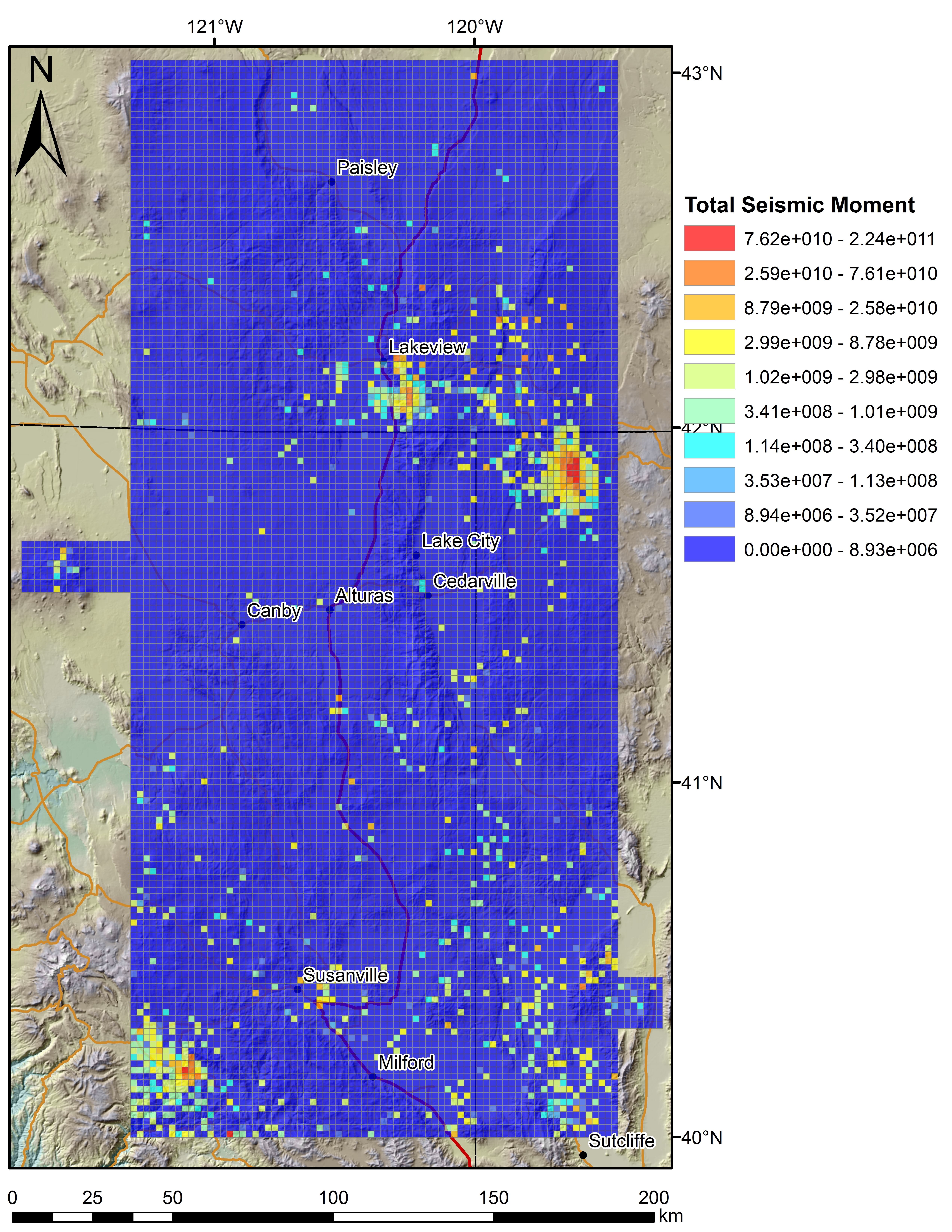
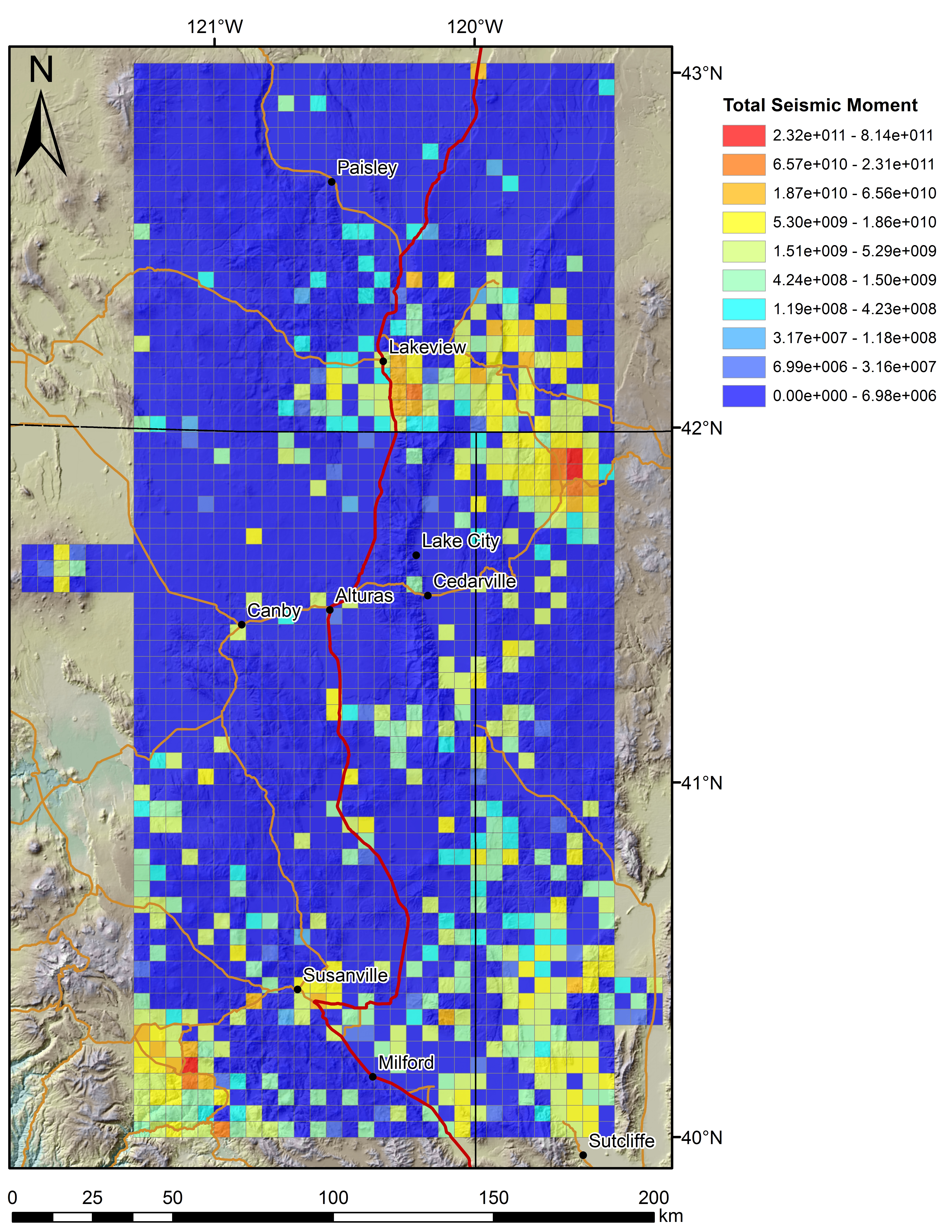
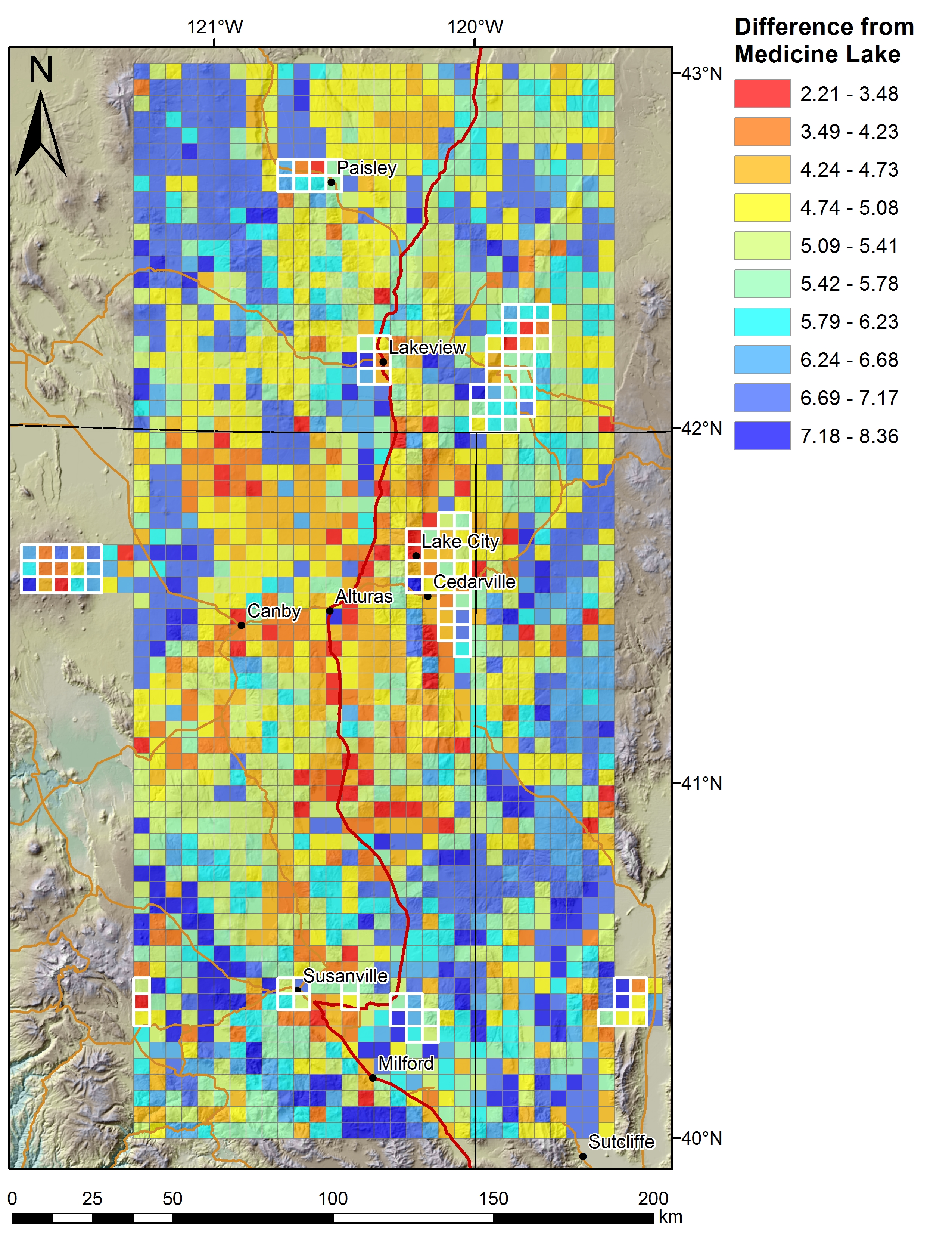
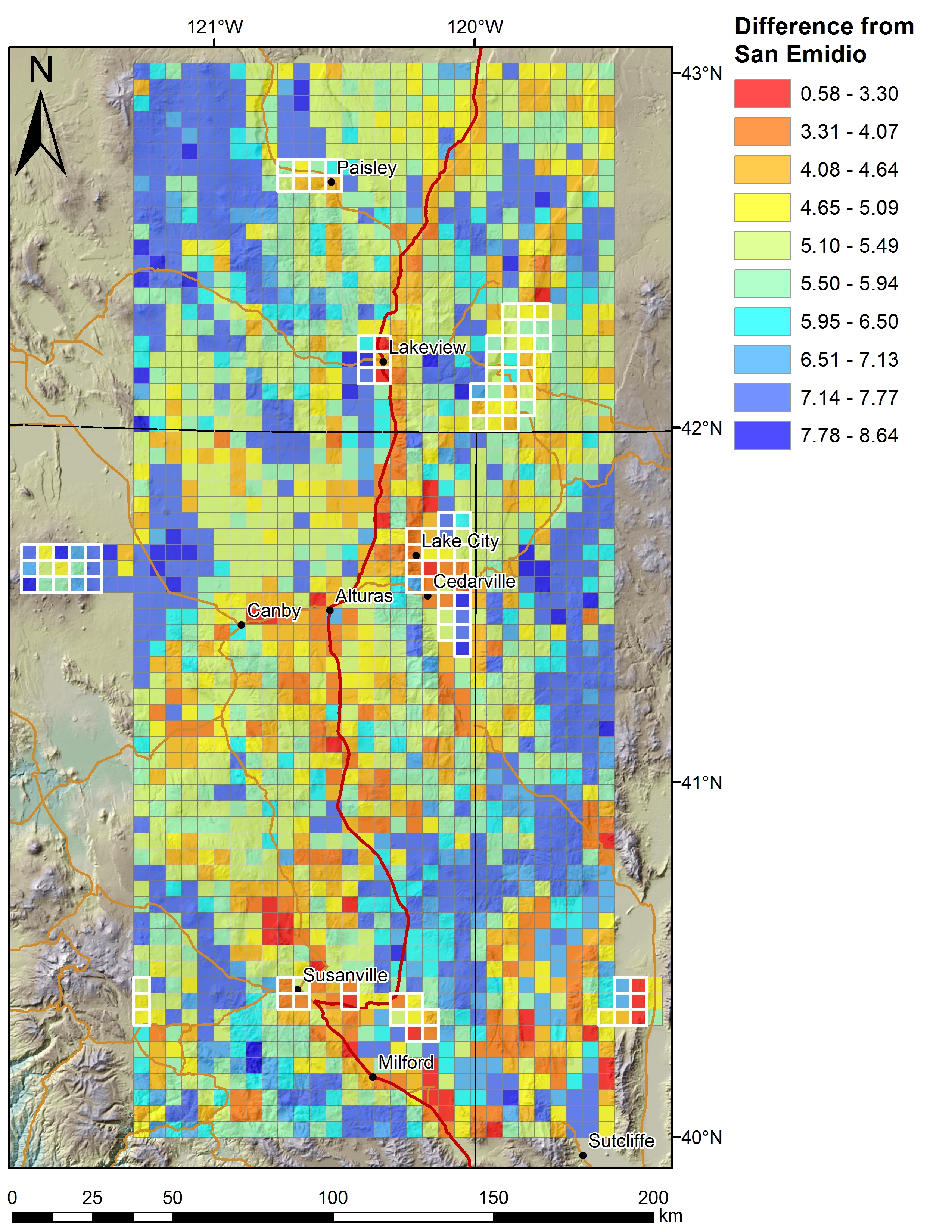
We are conducting an inventory of structural settings of geothermal systems (>400 total) in the extensional to transtensional Great Basin region of the western USA. A system of NW-striking dextral...
-
This dataset underlies the analysis of riparian ecosystems conditions and change along 12 rivers in Interior Alaska by Frost et al., entitled "Dynamic disequilibrium: recent widespread increases...
