
Search Data.gov
Found 365 dataset(s) matching "geothermal areas".
-
This map shows areas of anomalous surface temperature in northern Saguache Counties identified from ASTER and LANDSAT thermal data and spatial based insolation model. The temperature for the ASTER...
-
This file contains file geodatabases of the Mount St. Helens seismic zone (MSHSZ), Wind River valley (WRV) and Mount Baker (MB) geothermal play-fairway sites in the Washington Cascades. The...
-
x,y,z data of the 3D temperature model for the West Flank Coso FORGE site. Model grid spacing is 250m. The temperature model for the Coso geothermal field used over 100 geothermal production...
-
This report describes the geothermal resource at McGee Mountain, including: 1. Local geology 2. Thermal features 3. Known boreholes and temperature gradients 4. Geophysical surveys 5. Fluid...
-
A Life Cycle Assessment (LCA) spreadsheet tool was developed to analyze potential environmental benefits of a deep direct-use (DDU) geothermal energy system (GES) at the University of Illinois at...
-
This dataset includes magnetotelluric transfer functions in the form of EDI files for 16 stations collected by the USGS and 40 stations collected by Quantec Geoscience for Lawerence Berkeley...
-
Subset of all Aqueous Geochemistry, selected for UCD PF area only.
-
This data includes results on an analysis of existing and projected energy, cost, and carbon for the City of Ann Arbor - District Geothermal Design and Deployment to Equitably Decarbonize Low...
-
Sandia National Laboratories partnered with a multi-disciplinary group of subject matter experts to evaluate a stratigraphic geothermal resource in Steptoe Valley, Nevada using both established...
-
The Glass Buttes Project includes combining a suite of high-resolution geophysical and geochemical techniques to reduce exploration risk by characterizing hydrothermal alteration, fault geometries...
-
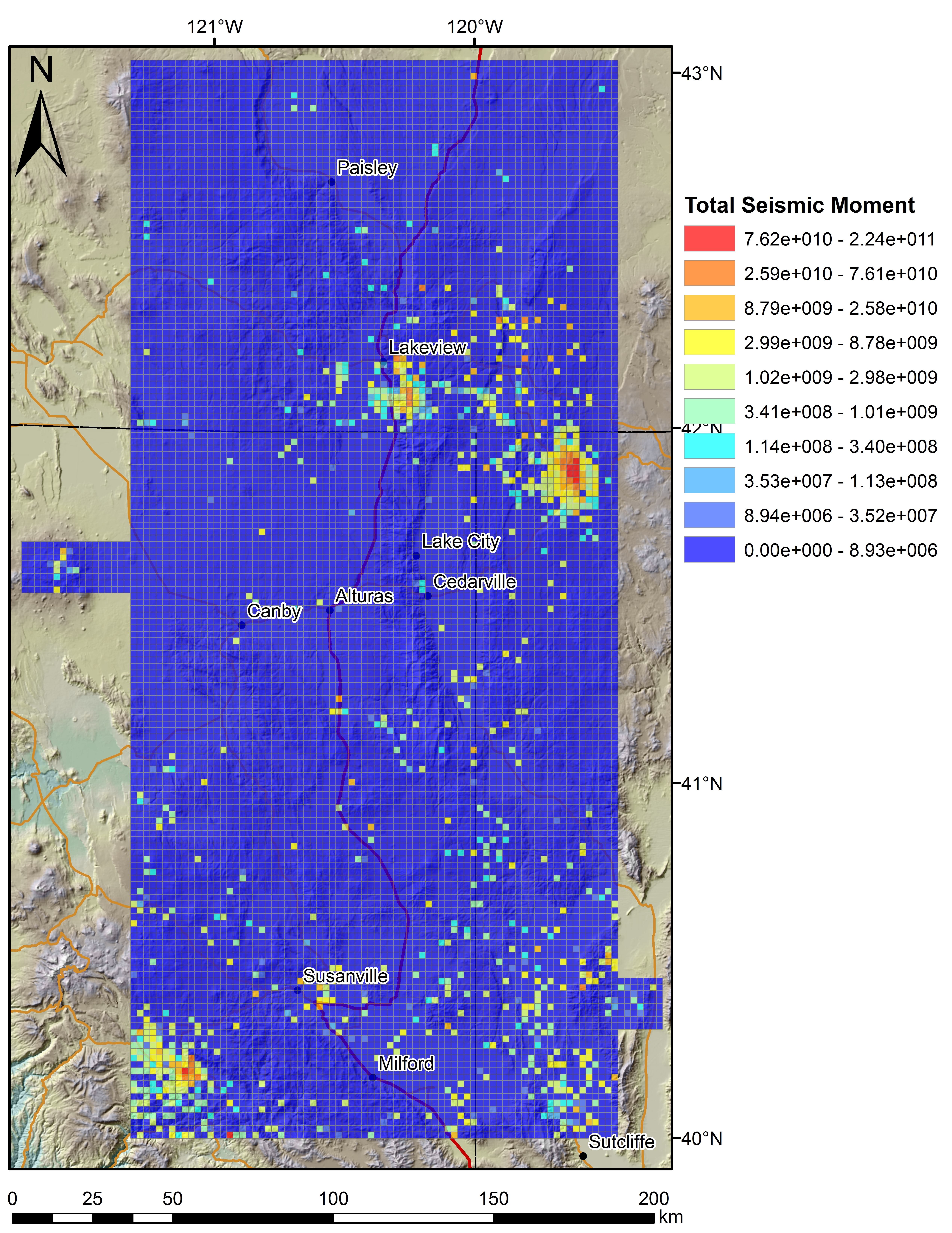
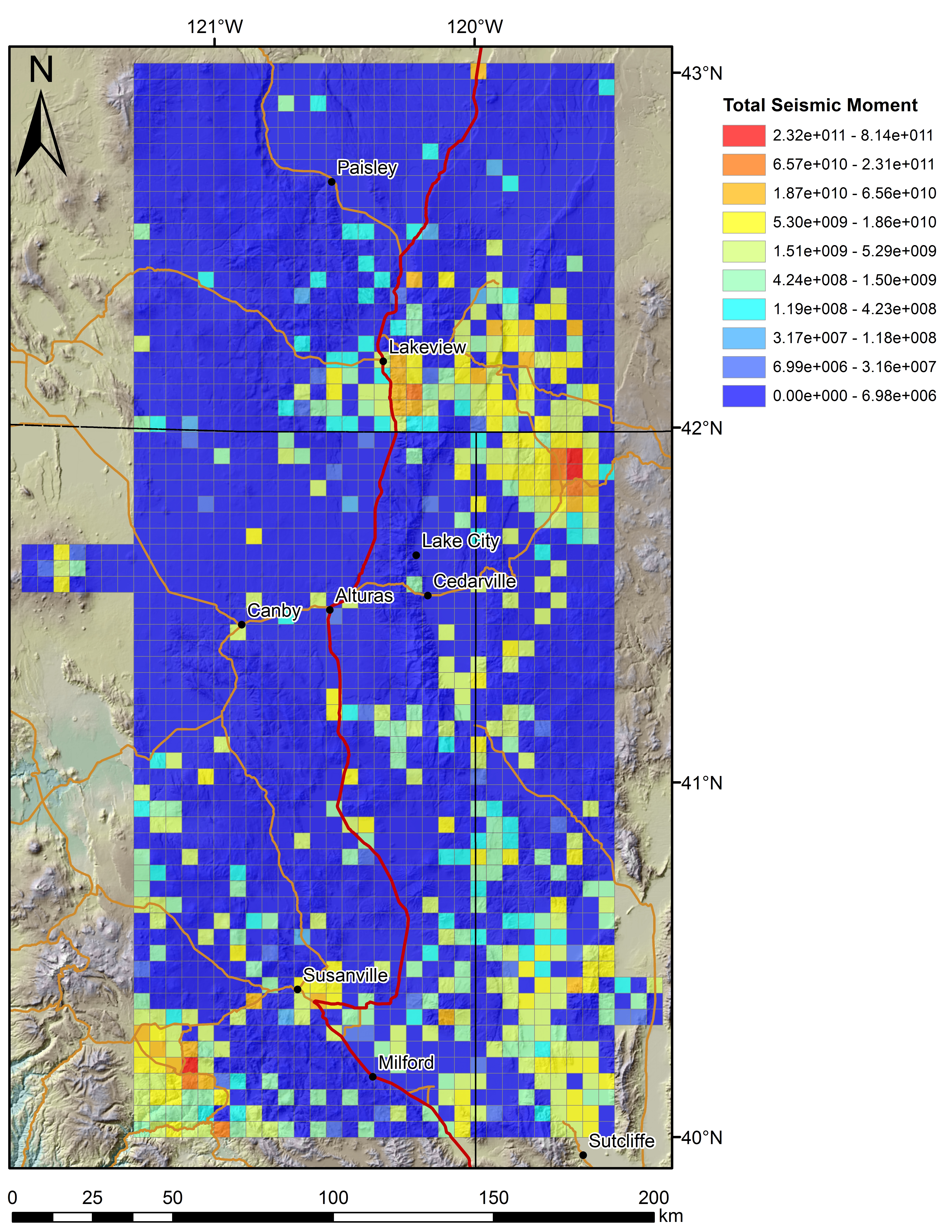
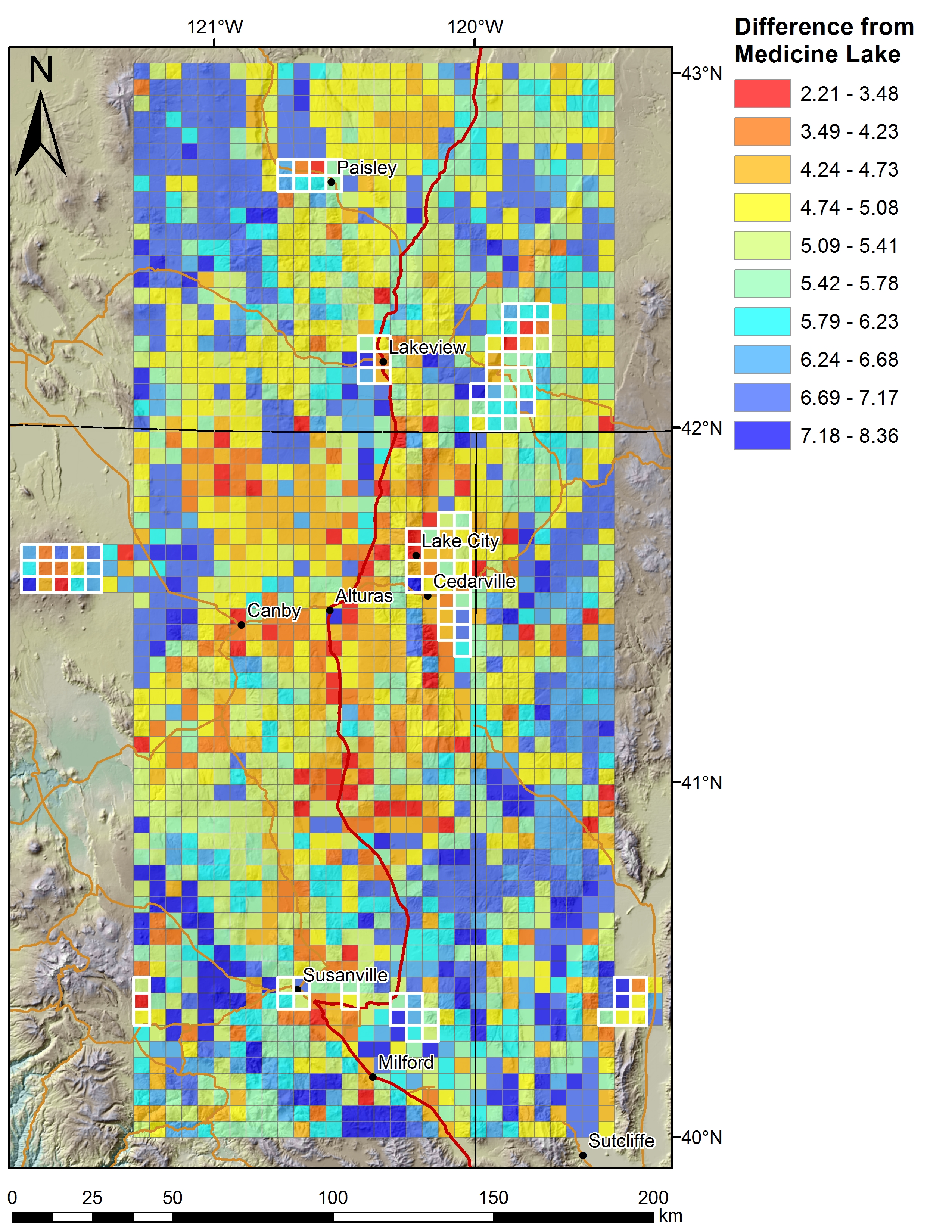
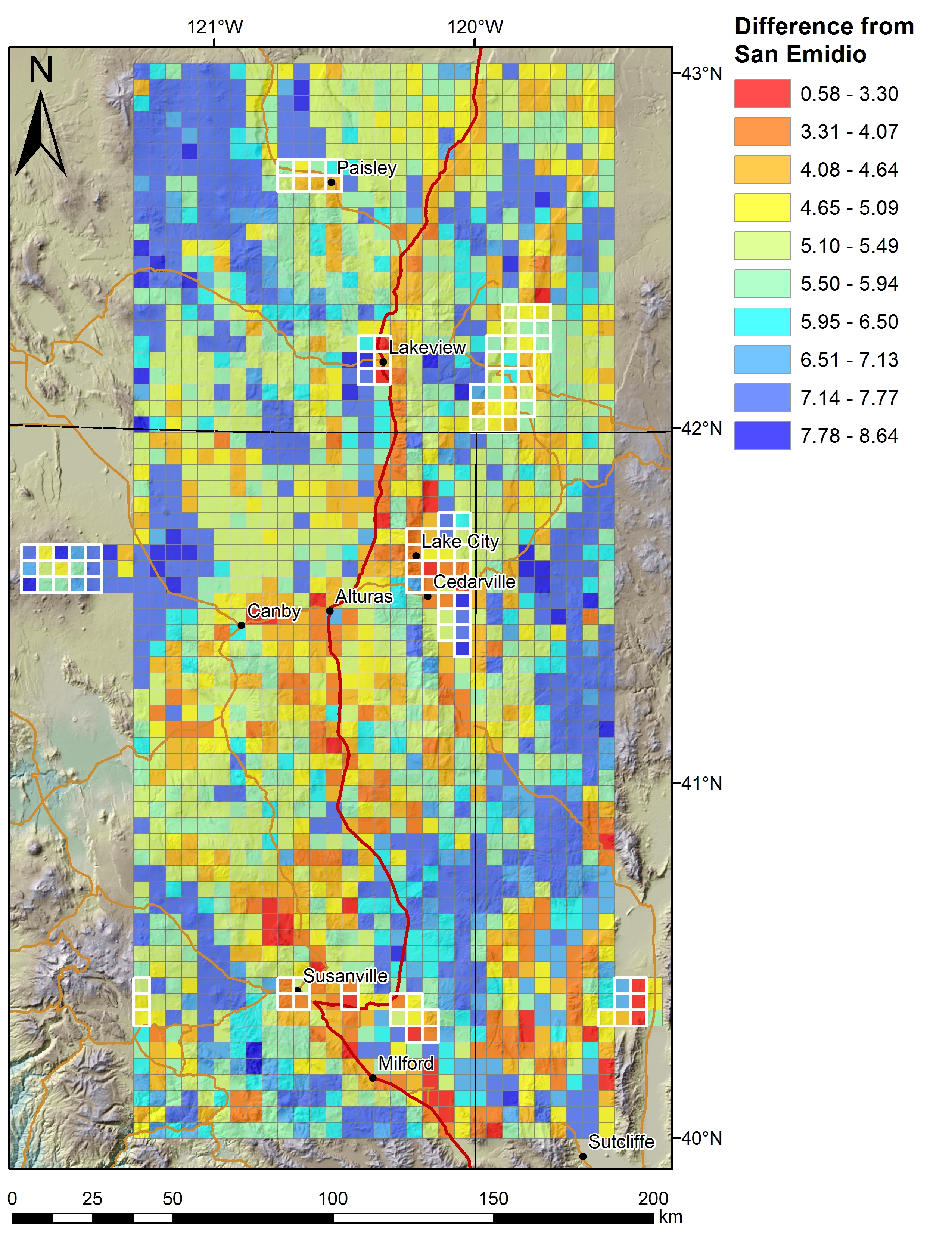
Tabular aqueous geochemistry data files for the Play Fairway Analysis CA-NV-OR area.
-
This report covers data acquisition, instrumentation and processing of a gravity survey performed on the Glass Buttes Geothermal Exploration Project, located in Lake County, Oregon for ORMAT...
-
Data resources were derived from a passive seismic survey of the northern St. Helens Shear Zone on geothermal leases 12-24 km north of Mount St. Helens for phase 2 of the Geothermal Play-Fairway...
-
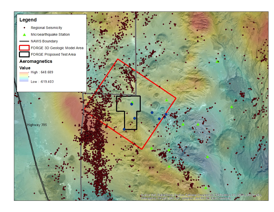
A map with the Coso West Flank FORGE test area outlined, along with regional seismicity, the aeromagnetic data set and the area currently being utilized for the creation of the 3D model.
-
Note: This "Weakly Anomalous to Anomalous Surface Temperature" dataset differs from the "Anomalous Surface Temperature" dataset for this county (another remotely sensed CIRES product) by showing...
-
Note: This "Weakly Anomalous to Anomalous Surface Temperature" dataset differs from the "Anomalous Surface Temperature" dataset for this county (another remotely sensed CIRES product) by showing...
-
This layer contains areas of anomalous surface temperature in Chaffee County identified from ASTER thermal data and spatial based insolation model. The temperature is calculated using the...
