
Search Data.gov
Found 1302 dataset(s) matching "State of Idaho".
-
This dataset is provided in support of the following publication: "Solar and sensor geometry, not vegetation response, drive satellite NDVI phenology in widespread ecosystems of the western United...
-
MT is measured in the field by using induction coils to measure the time-varying magnetic source for frequencies between 1000-0.001~Hz, and electric dipoles to measure the Earth's electrical...
-
This submission contains a link to two USGS data publications. Each data release contains all digital geographic data used and produced by the Snake River Plain Play Fairway Analysis for Phase 1...
-
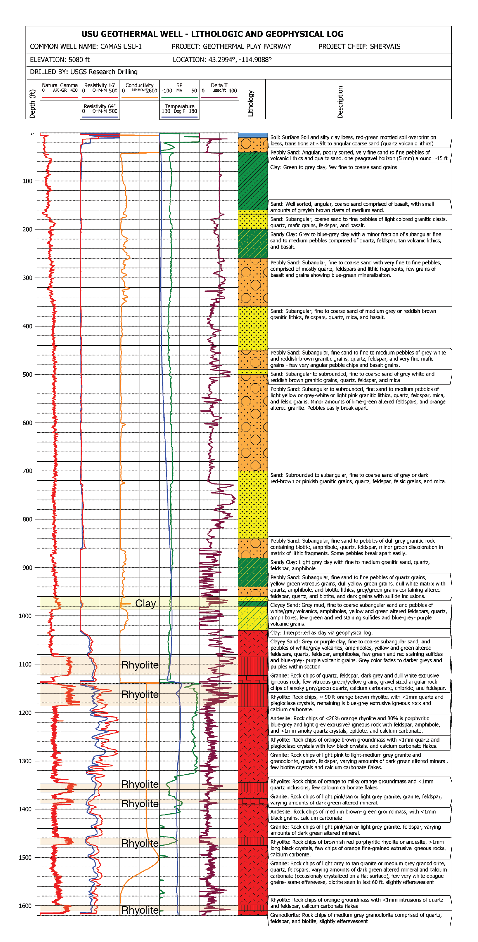
USU Camas-1 is a geothermal test well drilled in Camas Prairie, Idaho, in the Summer and Fall of 2018. The purpose of this test well was to validate Play Fairway methodologies of the Snake River...
-
This archive contains seismic shot field records for 10 profiles located in Camas Prairie, Idaho. The eight numbered .sgy files were acquired using a seismic land streamer system with an...
-
U.S. Geological Survey (USGS) scientists conducted field data collection efforts during the week of September 25 – 29, 2017, using a combination of conventional surveying technologies, for a large...
-
Groundwater is an important source of drinking and irrigation water throughout Idaho, and groundwater quality is monitored by various Federal, State, and local agencies. The historical,...
-
A mineral resource assessment was performed by the U.S. Geological Survey (USGS) to assess the potential of undiscovered skarn-hosted tungsten resources in the Northern Rocky Mountain region of...
-
In cooperation with the Idaho Department of Water Resources (IDWR), the U.S. Geological Survey (USGS) collected groundwater levels, geophysical logs, and video logs at eight monitoring wells from...
