
Search Data.gov
Found 1697 dataset(s) matching "resource potential".
-
<div style='font-family:"Segoe UI", "Segoe UI Web", Arial, Verdana, sans-serif; margin:0px; padding:0px; clear:both; color:rgb(0, 0, 0); font-size:12px;'><p...
-
<h4 style='font-weight:400; margin:0.375rem 0px 0.75rem; font-size:1.414rem; font-family:"Avenir Next W01", "Avenir Next W00", "Avenir Next", Avenir, "Helvetica...
-
Connecticut Quaternary Geology Long Island Submerged Marine Fluvial-Estuarine, Channel-Fill Deposits identifies early postglacial, channel-fill deposits submerged in Long Island Sound and Fishers...
-
Connecticut Quaternary Geology Geologic Basin Divides includes the drainage basins divides appearing on Sheet 1 of the The Quaternary Geologic Map of Connecticut and Long Island Sound Basin (Stone...
-
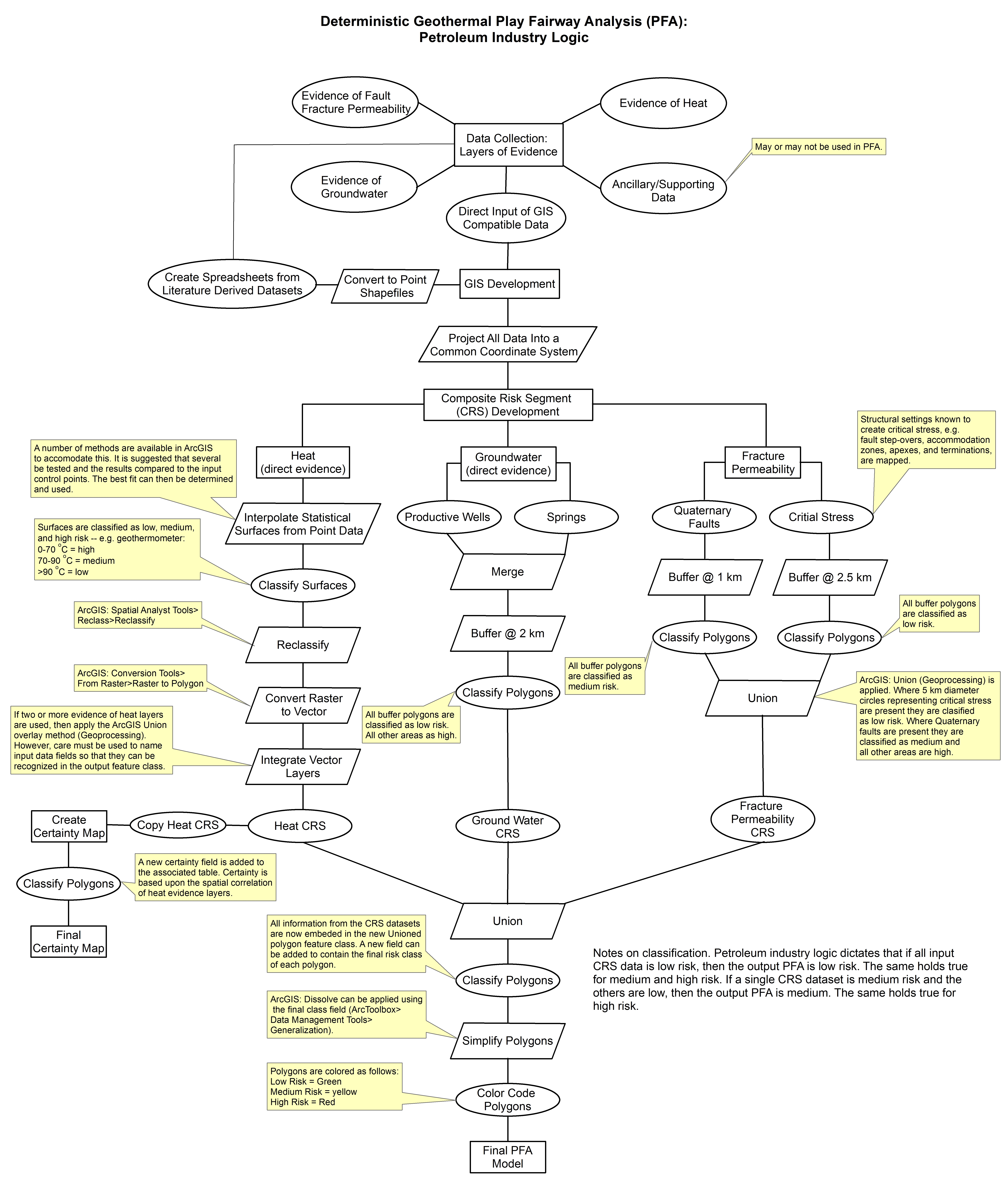
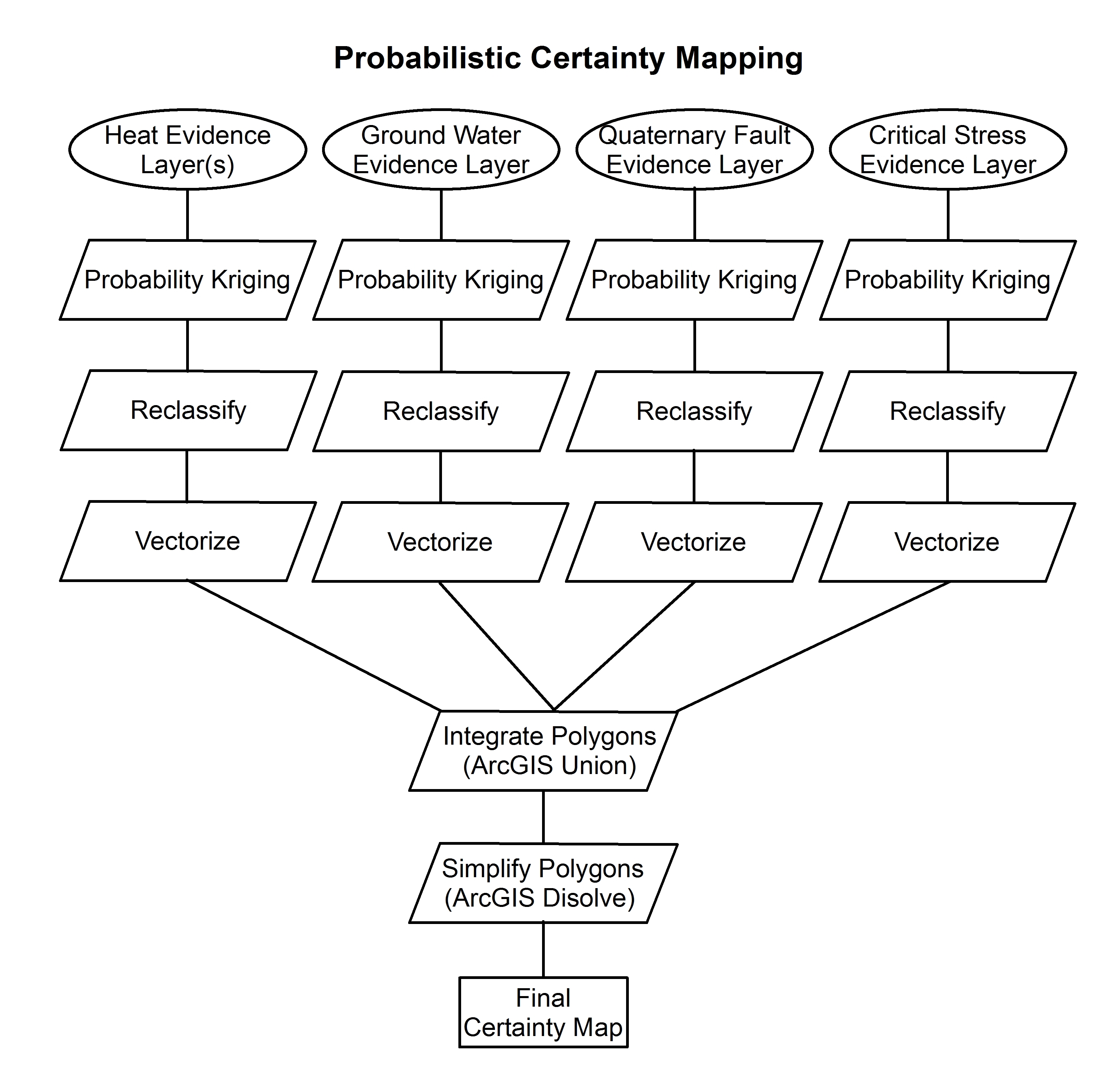
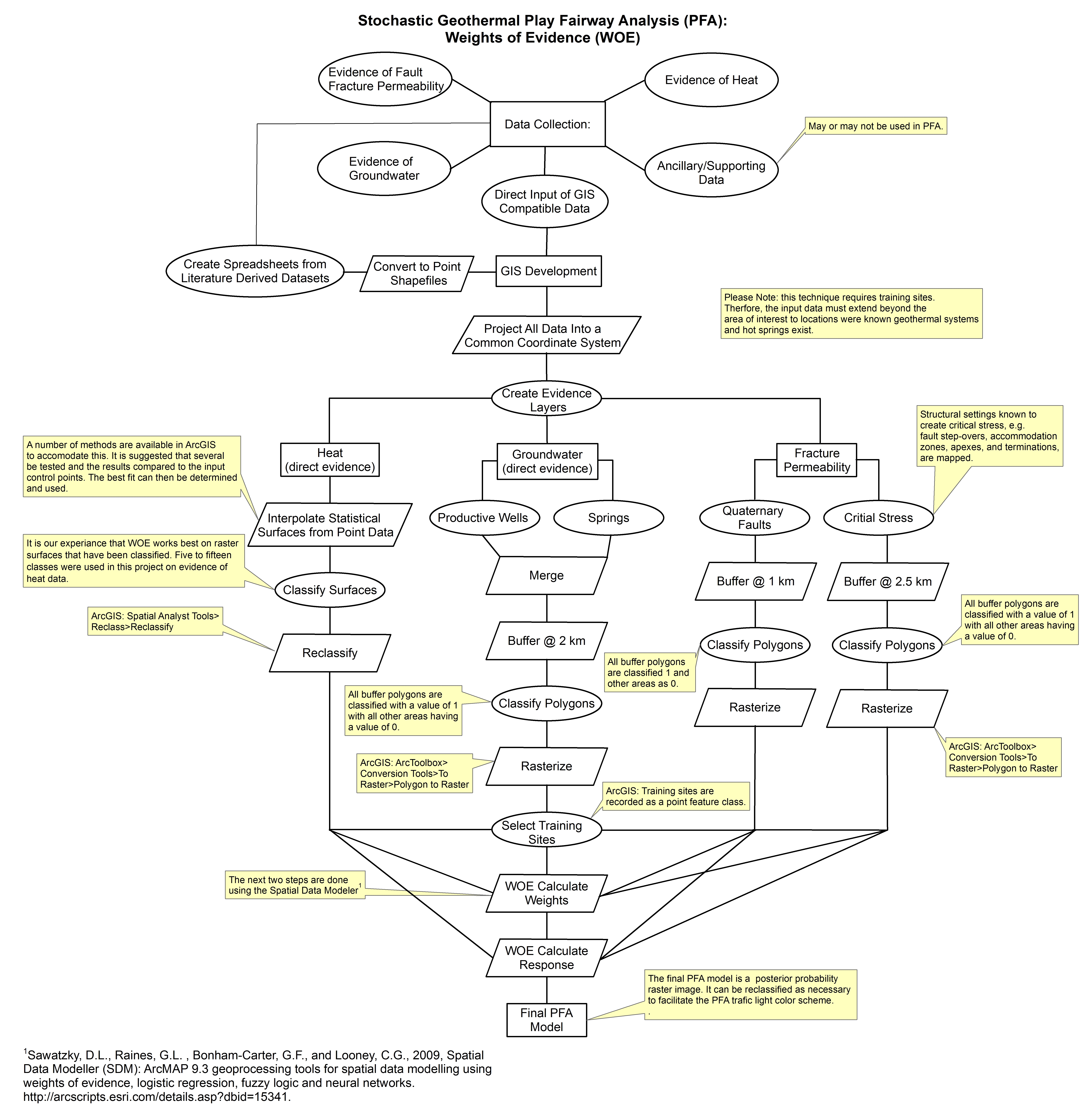
These images show the comprehensive methodology used for creation of a Play Fairway Analysis to explore the geothermal resource potential of the Tularosa Basin, New Mexico. The deterministic...
-
This data release provides the descriptions of approximately 20 U.S. sites that include mineral regions, mines, and mineral occurrences (deposits and prospects) that contain enrichments of lithium...
-
From 2016 to 2018, the U.S. Geological Survey, in cooperation with The New York State Department of Environmental Conservation, conducted a study of the glacial geology and hydrogeology of...
-
<p>The data shown in this web application accompany the CEC Land-Use Screens Staff report released in July, 2023. The geospatial land-use screens are intended to inform high-level estimates of...
-
The Yukon-Tanana Upland airborne magnetic geophysical data merge provides a merged raster grid of magnetic data for the Yukon-Tanana Upland (YTU), Alaska. This dataset provides a regionally...
-
This dataset contains the areas of surficial sand and gravel with water-resource potential within the study area. The delineated areas are the largest areas of glaciofluvial sand and gravel with...
-
In 2015, the U.S. Geological Survey (USGS), in cooperation with the New York State Department of Environmental Conservation (NYSDEC), began an appraisal of the sand and gravel aquifers within the...
-
A study was conducted to provide detailed mapping of glacial aquifers associated with the Fairport-Lyons channel system in Wayne, Ontario, and Seneca Counties, New York. The study was part of the...
